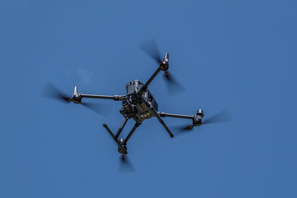
The XXL CFL drone on a data flight
Drones have been growing in popularity for several years now. And rightly so, because in addition to their use in the leisure sector, these small technical wonders are increasingly asserting themselves in the professional environment.
The professional use of drones is also becoming more and more commonplace at the CFL. However, in a much larger version compared to those used in the leisure sector, and therefore with the option of transporting additional equipment up into the air.
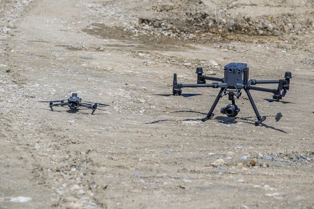
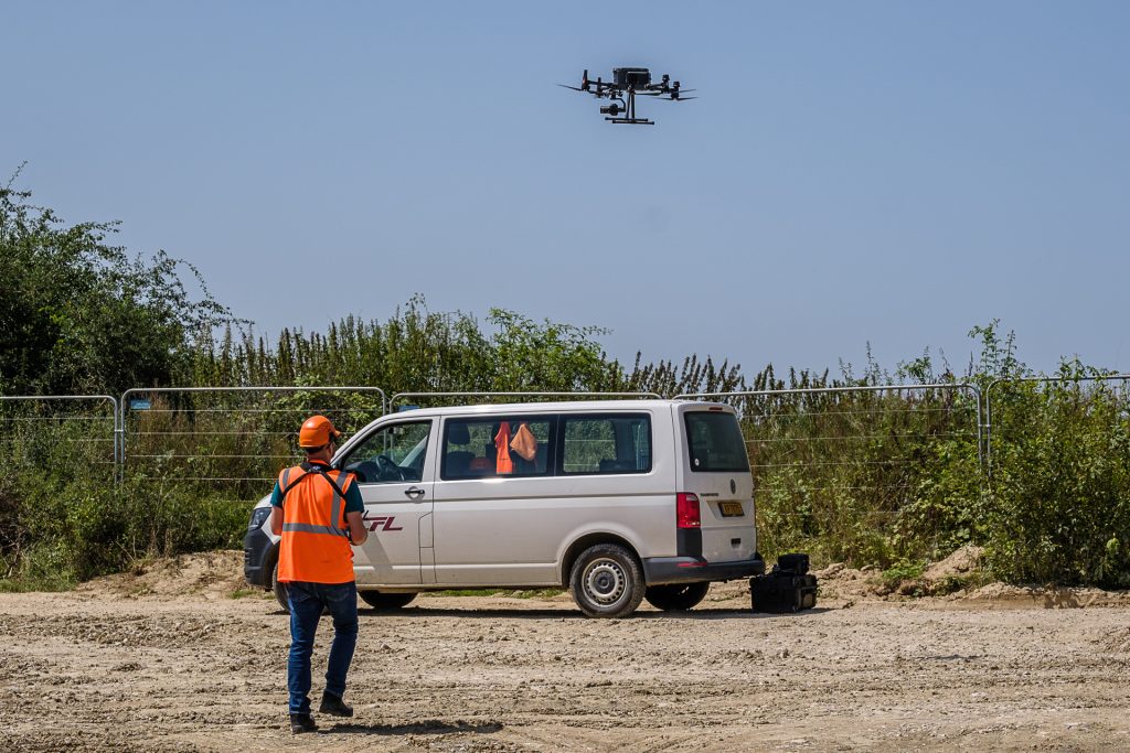
‘In the railway sector, drones offer us a whole range of advantages,’ explains Michaël, one of the surveyors for whom the use of drones is now part of his everyday work. Not long ago, Michaël received a new work device. At an impressive 1.5 metres, weighing in at six kilograms and with the option of mounting a further kilo of equipment and additional accessories, it is considerably larger than its predecessor, which weighed just under 950 grams.

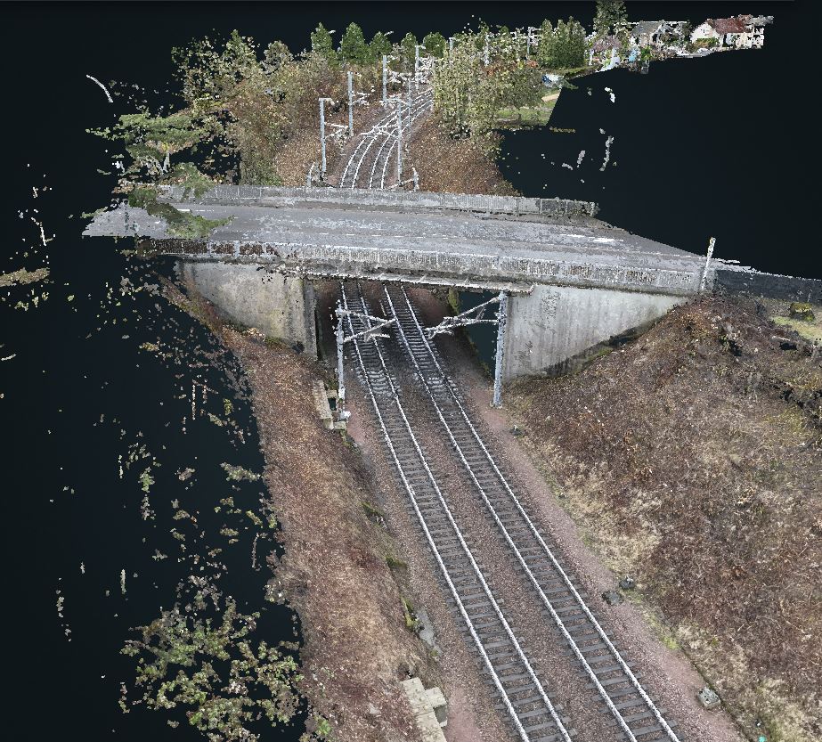
‘The new drone offers us a range of new possibilities, including the mounting of specialised equipment such as thermal imaging cameras or the use of LIDAR (Laser Imaging Detection and Ranging) attachments. The miniaturisation of electronics and the continuous increase in the accuracy of these devices are constantly improving the conditions for carrying out tasks such as photogrammetry for topographical surveys.’ In the past, these were only carried out by specialists in this profession of processing aerial photographs, i.e. creating detailed aerial images from which a 3D rendering is created.
More autonomous, faster, more efficient
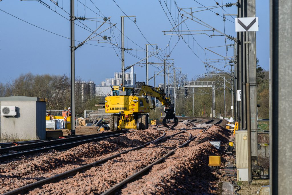
The use of drones is already a welcome help when it comes to technical troubleshooting or carrying out analyses. ‘In the past, carrying out analyses inevitably involved sending teams on site. To ensure their safety, it was often unavoidable to close the affected part of the line to train traffic. With the drone, I can help from the air in such cases and increase the safety of my colleagues and/or minimise any risks,’ reveals Michaël. The use of the drone helps to reduce on-site operations, and the data collected makes it possible to carry out the necessary analyses from the air. Existing work processes can also be adapted as a result.
This makes operations even faster, safer and, above all, more effective. There is no shortage of examples. Michaël cites one of his most recent missions in which the drone helped to identify an electrical problem. ‘Thanks to my images, my colleagues in the relevant department were able to identify the source of an electrical problem, but not only that. Thanks to computer modelling, it was also possible to directly determine the amount of cable that needed to be replaced as part of the pending repair,’ Michaël explains to us.
An exciting new technology with many advantages, including the ability to analyse hard-to-reach areas before heavy and complex equipment has to be transported and deployed on site. Precise views of large railway viaducts are one example of an application.
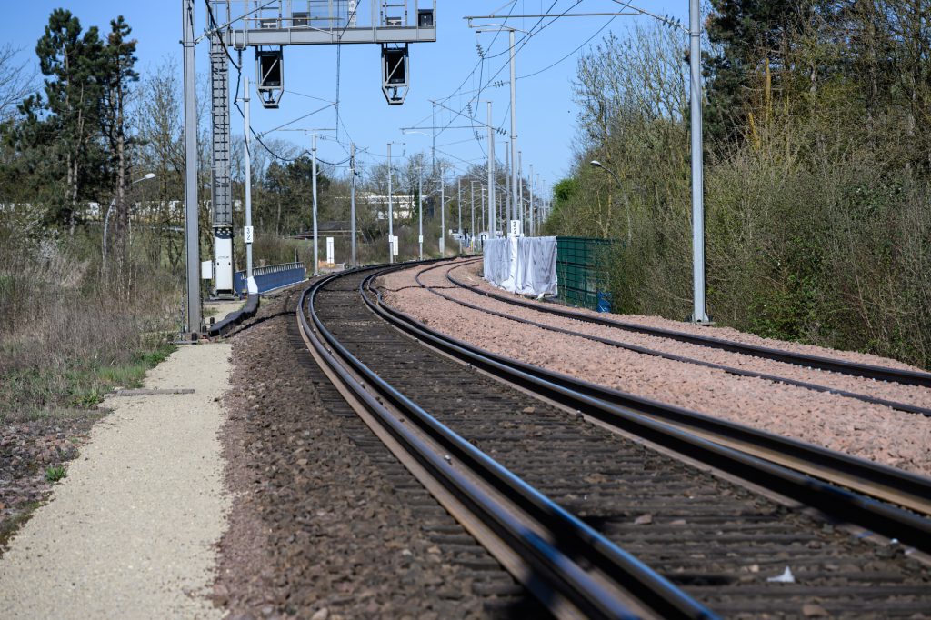
The new drone technology is an important element in the 3D modelling of the rail network. Michaël takes thousands of very high-quality images during each flyover. Subsequent computer processing is used to create a 3D model from the images taken and the LIDAR scans, which consists of clouds of countless points. Together, these points produce a detailed image of rails, sleepers, signals and overhead lines, track construction, etc.
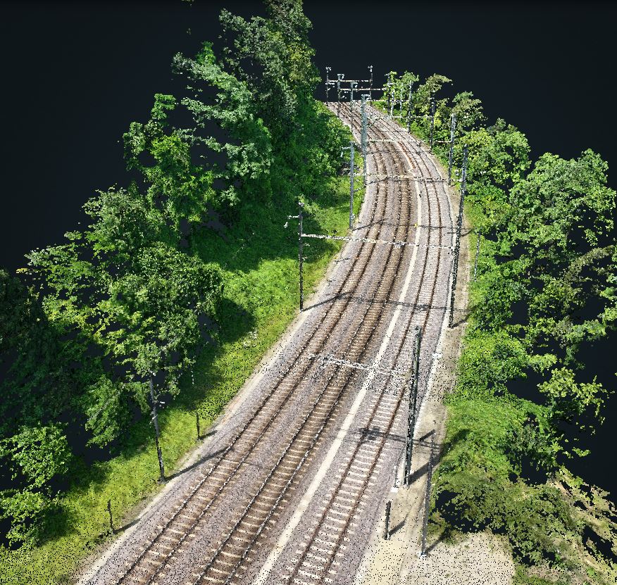
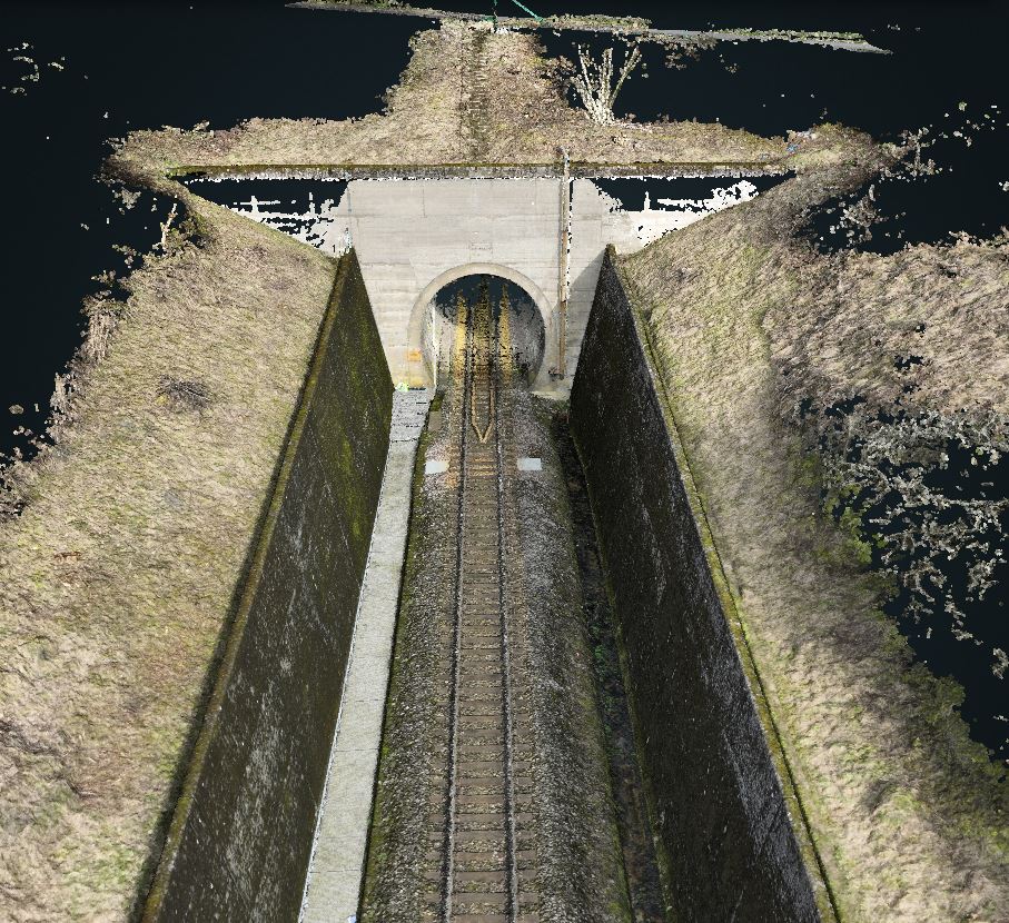
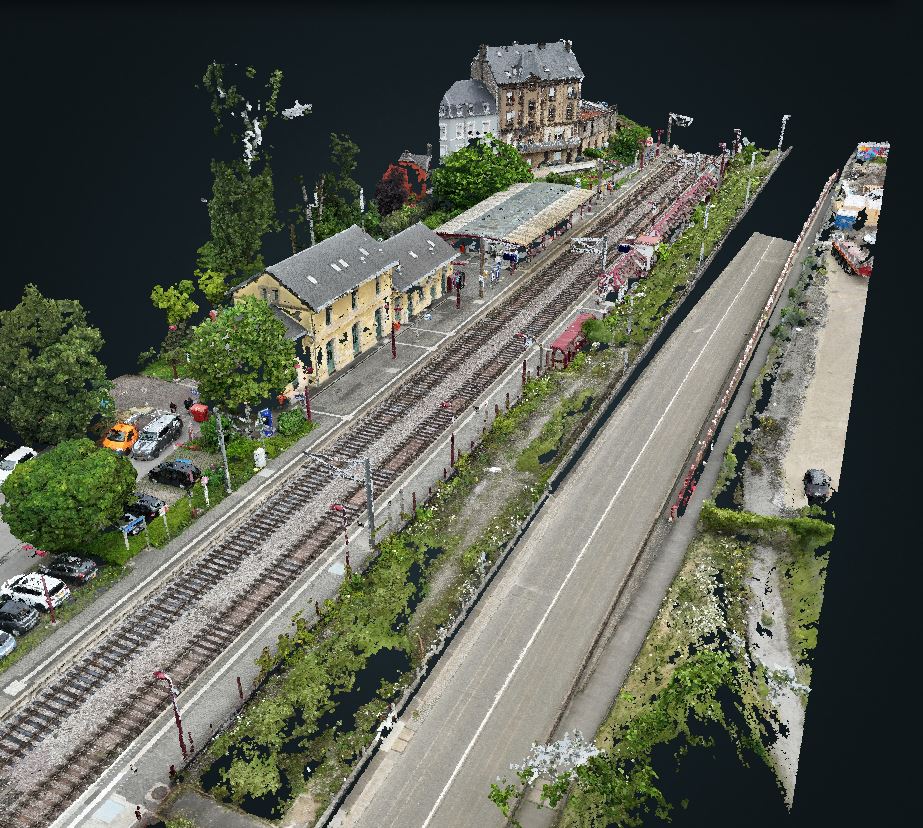
‘The resolution of the images is impressive. Depending on the settings, photos can be taken with an accuracy of up to one centimetre per pixel. And from a flight altitude of one hundred metres!’
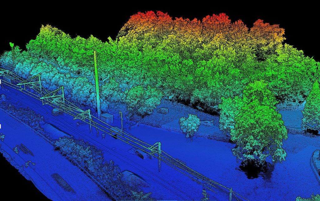
If the drone is also equipped with a LIDAR attachment (topographical scanning of the area flown overusing laser technology), the computer uses the data collected to create a 3D model of the infrastructure flown over and thus the basic data for the digital twin.
Drone and data pilot
With his work, Michaël makes an important contribution to the complete 3D modelling of the rail network and the rapid visualisation of reality on site, minimising the risk of unnecessary on-site operations.
Combining and sharing this collected data on a common data platform enables all parties involved in a project to plan and coordinate their work even better. An important database for building faster, with fewer resources and in a more coordinated manner for the mobility of the tomorrow.
Other articles you may like
-
 Behind the scenes16 Apr. 20263 minutes
Trains at a standstill, full activity on the tracks
Read more -
 engineering works/projects05 Sep. 20254 minutes
Technology and expertise lay the tracks for the future
Read more -
 engineering works/projects30 Jul. 20255 minutes
2.7 km track, 13 switches, 1 new platform… A productive summer for the CFL in Howald
Read more -
 engineering works/projects18 Jul. 20251 minute
Key questions about the CFL works
Read more -
 engineering works/projects02 May. 20252 minutes
The Luxembourg – Kleinbettingen – Arlon line prepared for the future
Read more -
 engineering works/projects09 Apr. 20253 minutes
20 switches carefully replaced between Luxembourg and Pétange
Read more